
Trace Kent Streets by Address
A Kent street search works best as a chain of evidence. The Portage County Auditor directs property research to Beacon, whose confirmed QuickSearch is labeled “Property Search: Parcel, Owner, or Address.” That result can identify the parcel, situs, owner field, tax-mail field, and legal description. It does not establish a complete household. The legal description and parcel number matter because they bridge a practical Kent address to the County land records that preserve a recorded transfer.
- Enter the Kent address, parcel, or owner lead in the Auditor property search and copy the parcel number, situs, legal description, and current ownership fields exactly.
- Open the County map route, find the parcel, and note its shape and adjacent parcel numbers before treating a Kent street number as a historic constant.
- Use the legal description with Portage Recorder eSearch. Search the titled owner as grantee to locate an acquisition record, then read the predecessor relationship.
- For a known person, Ohio My Voter Information can confirm a named registration and precinct after its required first name, last name, and Portage County search. The Board’s street-segment tool is for precinct geography, not a household browse.
- For a dated address listing, consult the Kent State University telephone-directory collection and use a street or reverse section only when that edition actually contains one.
That order keeps the Kent street directory grounded in source types. A parcel identifies land, a deed records a transfer, an election record addresses registration, and a directory records a listed subscriber at the edition date. If the goal changes from a corridor to one named person, the separate Kent resident search route uses a different, person-led method.
Kent Street Directory Parcel Search
Beacon is the first current-property stop for a Kent street directory question because the County confirms a single combined QuickSearch. The full interface was protected by an access layer during research, so only its captured controls should be treated as current. A dated parcel-card example shows the kinds of fields that may appear, including a parcel number, owner name, situs, mailing address, legal description, valuation, sales, and tax details. Treat a tax-mail field as delivery information, not an occupancy statement.
| Beacon field or mode | Input | When used | Kent record meaning |
|---|---|---|---|
| Property Search: Parcel, Owner, or Address | Combined text | Enter a known Kent parcel, owner, or address | Starts the Kent property and map route |
| QuickSearch | Action control | After a Kent search value is supplied | Retrieves the matching Kent route |
| Full Search | Linked route | Optional | Live options need confirmation |
| Manufactured Homes Search | Linked route | Optional | Separate County-linked route |
| Tax Estimator | Linked route | Optional | Not an owner or address lookup |
For a Kent record that is missing online, the Auditor and GIS have counter routes at the County Administration Building in Ravenna. Preserve the Kent viewer date with the Kent parcel number. Linked county map data may change after a deed, parcel split, or valuation update, so a Kent mismatch is a reason to check the dated custodian record rather than to decide that a field is wrong.
Kent Street Maps and Plats
The Portage GIS links page connects the property viewer with Recorder search, plat maps, scanned tax maps, and survey resources. On a Kent corridor, enter an address or parcel, zoom to the polygon, and record the parcel number and legal description before opening a related land-record link. Pan and select adjoining polygons only to understand parcel geography. The County has not documented a dedicated radius or neighbor control.
The Portage GIS and tax-map links page is shown below as the County’s route into the Kent parcel tools.
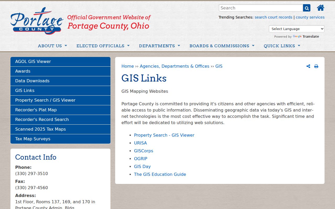
Use the linked maps to locate Kent land and map references, then confirm an old Kent boundary with the Tax Map office when necessary. The County warns that older or superseded surveys may no longer be shown as tax-map notes online, so an absent link is not proof that the survey never existed.
Kent Street Directory Deed Trail
The Recorder’s index is a name index, not an address roster. For a Kent parcel, find the current titled owner in the Auditor record, then search that name as a grantee in eSearch to find the acquisition. Confirm the legal description against the parcel. The acquisition record identifies the earlier grantor. Repeat that pattern with the predecessor as grantee, rather than trying to connect transfers with a street number alone.
The Recorder name-search screen provides the visible party, date, index type, group, and kind criteria that support a focused Kent deed search.
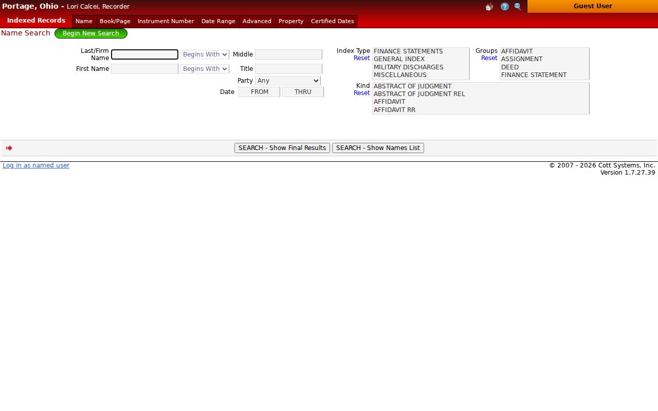
The online index begins in 1979. Routine document images are ordinarily viewable and printable from 2001 forward, while 1979 through 2000 results normally provide book and page. For an earlier record, or for a non-viewable document class, use the Recorder’s fourth-floor counter in Ravenna, email a copy request, or make a focused request with the document number or book and page.
Kent Address Records by Street
Each Kent street source records a different event. The parcel card follows tax and ownership fields, the map fixes parcel position, the Recorder keeps recorded documents, and a permit can date regulated work. Voter services are also limited: Ohio’s named voter lookup can confirm a registration and precinct, while the Portage Board’s street-segment route reports precinct and polling geography. Neither creates an official Kent household list.
| Kent address record | Custodian | Address connection | Access and limit |
|---|---|---|---|
| Kent parcel card | Auditor | Parcel, situs, owner and tax-mail fields | Kent property viewer or counter; not every occupant |
| Kent GIS and tax map | County GIS | Parcel geometry, plats, tax-map references | Online Kent map or physical map set; old surveys can be unlinked |
| Kent deed, mortgage, lien, plat | Recorder | Parties, legal description, document trail | Kent index since 1979; usual images since 2001 |
| Kent permit or code file | Kent Building and Community Development | Project or case chronology | EnerGov where accessible or a specific records request |
| Kent directory edition | KSU Special Collections | Dated listed subscriber and printed address | Physical collection; not a complete reverse run |
| Kent voter service | Ohio and Portage elections offices | Named registration or street-segment precinct geography | Not a public street-by-street person browse |
For City-held files, Kent’s Law Department accepts a public-records request by email or downloadable form, and writing is not required. Give the Kent address, date span, record category, and any permit or case number. Ohio’s Public Records Act permits prompt inspection or copies within a reasonable period, subject to the record’s legal exceptions and required redactions.
Kent Street Permit Files
Kent Building and Community Development direct permits, inspections, contractor registrations, and board or commission review to Customer Self-Service. A permit can place work at a Kent address and can date a project, revision, inspection, or closure. It is not evidence that every person associated with the project occupied the property. Research did not verify anonymous historical search fields in the live portal, so an unreturned search should be followed by a request for an existing file, not a broad demand to reconstruct a property history.
Kent’s permits and inspections page identifies the City route for a known address or project.

When a Kent permit cannot be found in the live interface, request the existing permit or code record with the address, approximate date, and record type. Building and Community Development are at 930 Overholt Road, and the City’s records channel remains the fallback for a documented file.
Kent Street Names Through Time
Old Kent street work needs the wording that appeared when the record was made. The City’s street-change table documents changes such as Normal Avenue to University Drive in 1935, Courtland Avenue to Temple Avenue in 1949, and the 1977 State Route 59 relocation associated with Haymaker Parkway. Later examples include Admore Drive to Stonewater Drive in 2007 and Alley #4 to Burbick Way in 2011. Search former and current names, then use the parcel’s legal description or plat to verify the connection.
Kent’s digitized 1889 Sanborn map supplies a second, date-specific view of streets, blocks, numbers, and building use.
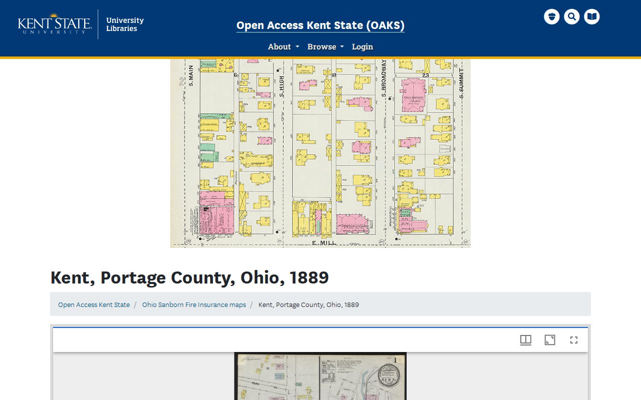
The map can anchor a Kent structure to its historic block, but it does not identify the homeowner or occupant. For early catalogues and newspapers, add Franklin Mills and Carthage to the place search because Kent carried those earlier locality names before the 1863 change.
Kent Street Directory Terms
These labels prevent a Kent address result from being overstated. Record each key as printed and keep the source date with it. A legal description can persist when a Kent street name changes, while a tax-mail field can change without a transfer of title.
- Parcel
- A County identifier for a defined piece of land. It is the stable join key between a Kent map and tax record.
- Situs address
- The physical property location recorded for tax and mapping purposes. It differs from a tax mailing address.
- Plat
- A recorded map that describes lots, blocks, or subdivisions and helps connect a street address to the legal land description.
- Criss-cross directory
- An address-oriented or reverse section in a dated directory. Kent researchers should confirm that the particular volume includes one.
In Kent, the same address may appear differently in a map, deed, directory, or permit because those sources track different things at different dates. Preserve the original Kent street wording before adding a verified modern equivalent.
Kent Street Directory Mailing Myth
Common misconception. A Kent tax-mail address proves that the named owner lives at the parcel. The Auditor separates the situs from owner and mailing fields, and the mailing field can be a post office box, trust, agent, or another location. A Kent owner field is useful for a land-record search, but it never identifies every person at the site.
Use a dated, independent source for the particular fact being checked. The KSU telephone directories cover 1918 through 2020 and can show a listed Kent subscriber in a particular edition. A Sanborn sheet can show a Kent building. A deed can show a recorded transfer. Each is useful Kent evidence, but none turns an address into a complete street roster.
Note: Kent parcel, directory, and map records are strongest when their specific dates and limits remain attached to every finding.
Kent Street Recorder Tip
Counter tip. A pre-2001 Kent Recorder result often ends with a book and page instead of a document image. That is a retrieval instruction, not a dead end. The Recorder’s office at 449 South Meridian Street, fourth floor in Ravenna, has the underlying record route, and its copy-request email is available when a document number or book and page has been identified. Ask for the page total before ordering an older instrument because the index’s image-page default can be incomplete.
Routine online images also exclude affidavits, federal tax liens, powers of attorney, and military discharges. Kent street research should state that limit and use the appropriate counter or request channel rather than treating an unavailable image as a missing record.
Kent Street Directory Limits
Property, map, and recorded-document systems do not show every Kent household member, utility customer, delivery recipient, or person temporarily present at an address. Ohio motor-vehicle information is restricted, and Safe at Home may lawfully substitute or obscure qualifying address information in property and voter records. A no-result can reflect a name change, protected record, historic street change, parcel split, or a source that does not index that question.
Lawful personal use. Use Kent address records for legitimate personal, family-history, property, or civic research. Do not use a record trail to stalk, harass, threaten, or harm anyone, and do not try to work around protected information.
For a focused Kent request, name the parcel or situs, the record class, and a date range. The correct custodian can explain whether an existing record is open, redacted, sealed, or available only through a counter or formal request.